Low Point Lighthouse, NS

Low Point Lighthouse, NS

Thursday, 27 October 2016

El Morro National Monument, El Malpais National Monument and Blue Water Lake, Grants, NM Oct 24 - 26 2015

Oct 24

Monday morning with only an hour's travel from Gallup to Grant's New Mexico, we enjoyed a lazy morning and did not get the jacks up until 10:00 am. We arrived and searched for one of the few campsites available at a Good Sam Park. A lot of the sites are taken up with seasonal workers it seems.  As the clouds were coming in, there was no point taking pictures of the El Malpais National Monument area.  We decided to take the short trip to Blue Water Lake State Park instead. Very disappointing. The pictures on google must have been well before the water levels went down as now it is more of a large pond. It definitely shows how "water poor" the lower states are. The parks people are doing a lot of work though, with new park facilities being built. No one was camping there today.

Image result for blue water lake nm
Before picture 2009

Look at the boat ramp high and dry Oct 2016
Oct 25

Tuesday morning, as it was still cloudy, we decided to see the Ice Cave and Bandera Volcano first on our way to the El Morro National Monument. After leaving the Trading Post you take a short walk down a trail with lava on both sides showing collapsed lava tubes and even an old Anasazi ruin, you come to the staircase down to the ice cave. It was really cool, literally. You could definitely feel the temperature difference as you descended down the staircase to the viewing platform over the ice. Apparently it stays at 31 F. year round. The ice cave was formed after the collapse of a 17.5 mile long lava tube from the Bandera Volcano that blew over 10,000 years ago, which is also on the property. This ice cave is around 8000 feet and the viewing platform to see the crater is 200' higher.

Anasazi Ruins ... stacked stones under the pocket of lava.

Dem bones dem bones in the lava flow ... close to Halloween.

Stairs down to the ice cave.


Since coming into New Mexico with the higher elevations over 6000 feet, I am having a little difficulty with being winded easily at this elevation. I seem to be fine at 5500 feet but as soon as we break 6000 feet the feeling comes back. I did not take the trail up to the volcano but Ray did.

Lava flow from the top of the volcano ... it went 23 miles.

The cone is 1400 feet wide and 800 feet deep.

The Continental Divide runs along the left ridge of the cinder cone.

The Trading Post and property have been in the same family for 3 generations. The trading post acted as a saloon and store years ago servicing the community. When the community for the most part dispersed, the host's grandma said she wanted the saloon closed and wanted the property to become a tourist attraction.

Trading Post (Old Saloon and Store)
It was interesting talking with our host. She is getting on in age as well but plans to keep letting people visit the attraction as long as she can. Several of her sisters have summer houses on the property as well. They are only open from May until the end of October so we were lucky to be here before they closed for the season. There is a house fifteen miles towards Grants, that also belongs to one of their relatives.  They purchased the house in pieces from Sears and Roebuck and assembled it years and years ago and is still standing. We noticed it driving by as it has a brilliant blue roof and then we saw the picture hanging on the wall in the trading post.

Family History

Below the house as it is now. Other than new blue roof tiles the rest of the facade is in need of repairs.


Once back on the highway we headed to El Morro National Monument. It is one of the smaller monuments with only 1000 acres. The main feature of this place is the Inscription Rock, a huge sandstone bluff. El Morro is Spanish for "the headland or the bluff". Travelers stopped at El Morro for centuries to drink from these reliable waters. There is no spring. The pool is fed largely by rainfall in July, August and September and by melting snows. The black stripes that ribbon down the cliff face are the "spillways". When full the pool is about twelve feet deep and holds about 200,000 gallons of water. The pool never empties but evaporation can shrink it from its banks until it is refilled by precipitation.

Inscription Trail


Cliff Swallow nests. They come every spring.

Image result for cliff swallows
(Picture from Google)

Hundreds of years after the Ancestral Puebloans moved on, Spaniards came by here as early as 1583 by Antonio de Espejo and marks the next 200 years of visits by Spanish travelers. 266 years after Espejo's visit, members of the United States Army surveyed the area for a new route west, beginning the next wave of visitors as part of America's westward expansion. Each group left small bits of their story inscribed in stone and reminding us that they stood by this pool as well.

The first governor of New Mexico in 1605, Don Juan de Onate.


Ramon Garcia Jurado passed through here 25 June 1709 likely on a campaign against the Navajo. This inscription was darkened by a graphite pencil in the 1930's, a practice they parks people no longer do.


Some of the oldest inscriptions are petrogylphs.


A great walk and very interesting. The trail continues up to the top of the bluff to see some old Anasazi Ruins but we did not do the 1 1/2 mile trail up 300 feet to see the ruins at the top and then take the 130 + stairs back down. Although the ruins contain over a hundred rooms, they have only excavated about 10 of them.

Image result for el morro ruins
From Google

After this exercise, we stopped at this little country restaurant and had a scrumptious lunch. This is in the middle of nowhere! Ray ordered homemade smoked beef brisket with habanero apricot sauce and I a toasted clubhouse with turkey, bacon and avocado and some medium spicy mayo. Ray's brisket was an inch thick! Delicious. Everything was organic and local. The prices were very reasonable.


Time to go home and let Freya out of the coach. It's nice to plug in to have the A/C on for her back at camp. Tomorrow El Malpais National Monument.

Oct 26

After getting some laundry done and a big breakfast with Freya in tow we drove to the El Malpais National Monument. Most of the monument highlights the huge lava flow in the valley. At one time there were 29 volcanos in the chain and they all exploded. The lava field is huge. We've never seen anything like it.

The highway along the lava field

Lava Field
The first stop is the Sandstone Bluffs. The drop to the valley floor is 1000 feet. I sure kept good control of Freya although she is pretty good about not going over drop offs. Absolutely stunning.


Further down the road is the La Ventana Arch. The colours in the sandstone are spectacular.


The next area is "The Narrows". This is were the lava flowed right up to the base of the sandstone cliffs.


Driving by these bluffs Ray spotted another smaller arch and a "window.


After reaching the Narrow's Picnic Site we decided to turn around as this road goes for miles and miles. The drive today was much shorter so we spent the afternoon doing chores in preparation for our departure tomorrow.
Good Night!

Sunday, 23 October 2016

Rock City Park, Gallup New Mexico

Friday we were on the road by 9 am for our next destination, Gallup New Mexico. It is only a 2 hour run so we arrived shortly after 11 am. They have beautiful red sandstone cliffs here which Ray wanted to photograph. Gallup is also known as the place with the biggest inventory of all North American Indian crafts and jewelry. They ship their stuff all over the place. So .... something for Ray to see and something for me to see.  Although Albuquerque is known for the International Balloon Festival, Gallup also has one in December where the balloons all launch from Red Rock City Park. Unfortunately we will not be here to see it then. Balloon tours though start here as well so maybe we will get lucky and see some. Also located here are horse stalls and arena's where they host their rodeo. It is quite a huge facility.

Red Rock Campsite is $20/night with water and 50 amp power. They do have a sani-dump. Most of the sites are well-spaced and would fit any rig.  I turned on the water and it came out rusty so we will just use the full tank of water we have and re-fill at our next stop so our ice does not get contaminated. Everyone else here uses the water for washing etc. Below is our campsite with Church Rock in the distance. Absolutely stunning.


There is lot's of sand here for Freya which she absolutely loves. She does need her boots though on the trail towards Church Rock ... Ray came back with his soles full of goathead checking out camera angles. There are a few hiking trails in the area behind the park going into the canyon towards Church Rock and another one to Pyramid Rock. A lot of people come here to do those.

Ray and I checked out the museum that is located in Red Rock Park. Very interesting. I think I now see where some of the glyphs we viewed at the Petroglyph National Monument came from. The heads were from ceremonial outfits. At the museum we saw Kachina Dolls that had the same head dresses on and also sand art depicting those features. "Kachina dolls are figures carved, typically from cottonwood root, by Hopi people to instruct young girls and new brides about katsinas or katsinam, the immortal beings that bring rain, control other aspects of the natural world and society, and act as messengers between humans and the spirit world."


Image result for kachina dolls
Two examples of a Kachina Doll from Google


Sand Art at the Museum


As the sun set, Ray rushed out to get some evening shots of Church Rock. Apparently the pictures are better in the morning light so he will try that tomorrow morning.

Next it was the Navajo Wingate Village Area.


What a gorgeous evening. It was cold overnight though ... 28 F/ -2 C which ever way you wanted to look at it. We are at 6470 foot elevation. Days are forecast to be warm though around 73 F.

Saturday morning first thing, Ray did his walk with Freya to get some sunrise pictures.


The next three shots are of a 50' dry waterfall.


Once he returned, it was time for showers to get ready to go into town. A lady came by and knocked on the door and asked Ray if he wanted some fresh burritos for $1 each. Of course he said yes and took two. They were so filling he could only eat most of one of them even though it was quite tasty and will save the other for tomorrow. He said they were quite spicy so I passed.


Now it is time to go off and explore Gallup. Saturday mornings they have a huge flea market.

The market is huge, the smells from all of the authentic food cooking are awesome, too bad we had already eaten. Lots of Native American Jewelry and art but a lot of junk too. Several vendors even had puppies and even two booths with tires, for sale. 


Pony rides for the kids.

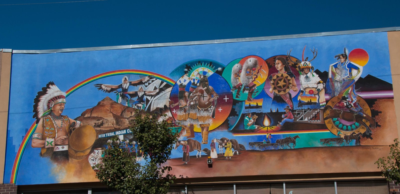
Then we went to a few Trading Posts to have a quick peak and noticed these murals.

Old Route 66 ... lots of trading posts.
Mural recognizing contribution of the Navajo Code Talkers during WWII


We were back at camp for lunch and rest up for the afternoon. Ray's walk this morning taking pictures, plus the market, caught up with him, so some "rack time" was necessary.

Tonight after Ray rested all afternoon he will be out taking some sunset pictures. Unfortunately the clouds are coming in for tomorrow night so he is unable to space it out. Oh well... tomorrow will be a rest day before we move on Monday morning only an hour up the road.

Church Rock at Sunset (looks the same at sunrise I think. lol) 
Pyramid Rock at Sunset

Pyramid Rock at Sunrise

There is a trail between Church Rock and Pyramid Rock for hiking for those who like to explore on foot.

As an add-on Ray came to get me as he saw a balloon in the sky near us. I had been watching every morning hoping one would come by. Here are some pictures.


After racing up the road to see it land we came back to camp and saw this??? Do not know what it is for, maybe a remote car?